From the famous Hollywood Sign to the Cave of Munits, LA has a large array of hikes varying in scale and assortment. With unique experiences like the abandoned Murphy Ranch featuring an endless looking staircase and graffiti architecture to the Bridge to Nowhere, showcasing bungee jumpers and river gold miners. No matter your taste or hiking abilities the city has more than enough options to keep up with your pace!
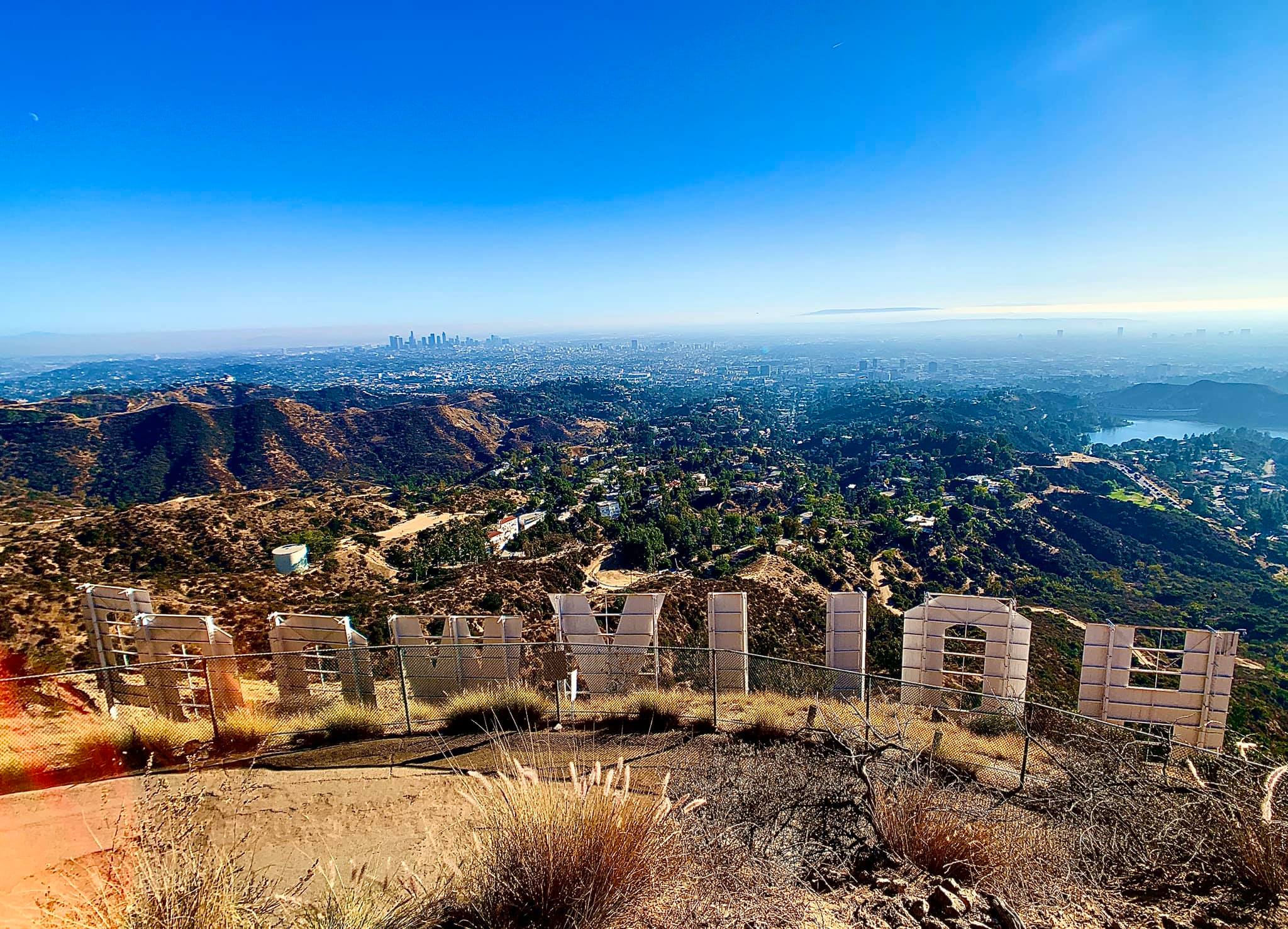
The Hollywood Sign Hike
Location: Lake Hollywood Park (3160 North Canyon Drive)
Don’t dismiss this hike as tourist rubbish. It’s a true local gem! For the full experience, you’ll want a solid shot in front and behind the sign. Start by parking your car for free at Lake Hollywood Park on Canyon Lake Drive. (You’ll see other cars parked along the side of the road.) Next, you want to hike straight up the hill the entire time, but stay to the left every time the road splits. You’ll see several signs saying not to drive up Mulholland Hwy. Stick to the left and walk up that street, you’re going the right way! You’ll first walk through the neighborhood which eventually turns into a dirt path, keep going until the dirt path ends and you reach the white wall entrance to Mt. Lee Summit. Go through the gate and up the small hill to the right and get the closest picture that is possible in front of the Hollywood Sign! For the full experience, walk back down the small hill and continue straight up the paved road (Mt. Lee Drive), to get to the summit behind the Hollywood Sign. It’s about a one-mile hike. Snap a pic at the top! Then take a moment to talk to other hikers who made it there. Locals and people from all around the world are inspired to take this hike. You’ll be sure to get inspired and meet some very interesting travelers!
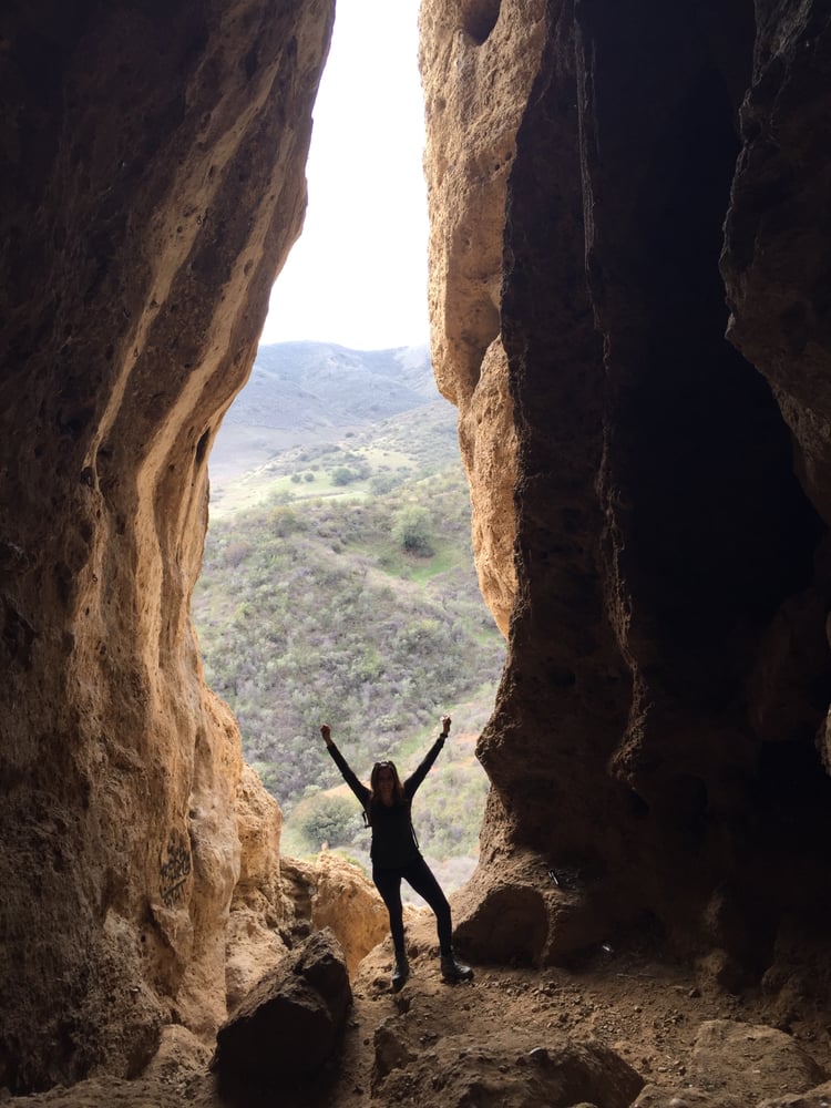
Hike to the Cave of Munits
Location: El Escorpion Park
Are you looking for a hike that’s an action-packed adventure? Rarely does a 2.1-mile loop offer as much excitement as the hike to the Cave of Munits. You start by hiking up El Escorpion Trail, a wide dirt trail parting from a bend at the end of Vanowen Street in West Hills on the western edge of the San Fernando Valley. El Escorpion Trail (labeled Moore Canyon Road on Google maps) starts with head-on views of Castle Peak, before curving left to proceed west into the canyon below Castle Peak. Shade is scarce along the way, so be sure to wear sunscreen! Stay straight past several paths breaking off to the right (one of which will be your return route down from Castle Peak). No gear is necessary to get through the cave, just an adventurous spirit that will lead you out the top of the cave to a tough off-trail ascent to Castle Peak. The view at the top is a panoramic summit towering over the west end of the San Fernando Valley. The loop closes with a swift descent from the crown of jumbled rocks.
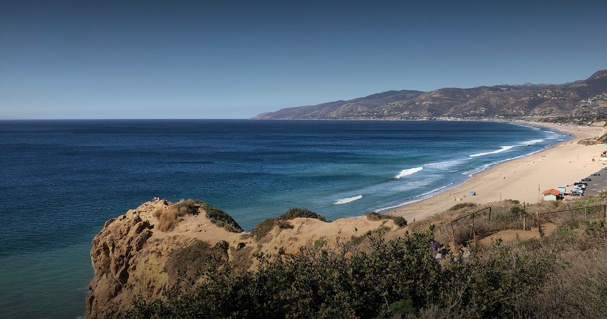
Point Dume Cove Trail Hike
Location: 1657 Ocean Ave, Santa Monica, CA 90401
Check out Point Dume Cove Trail for a family-friendly accessible hike! The trail offers that classic Malibu scenic overlook made famous by the final scene of the “Planet of the Apes” film, where the Statue of Liberty lay buried in the sand. Point Dume Cove Trail is a 1.4-mile moderate hike featuring beautiful wildflowers, sea lions on the rocks below, and rock climbers scaling Dume Point. A great trail for all skill levels but parking is limited to about 6-7 spots for 2 hours, so it’s best to do during the week to secure your parking spot.
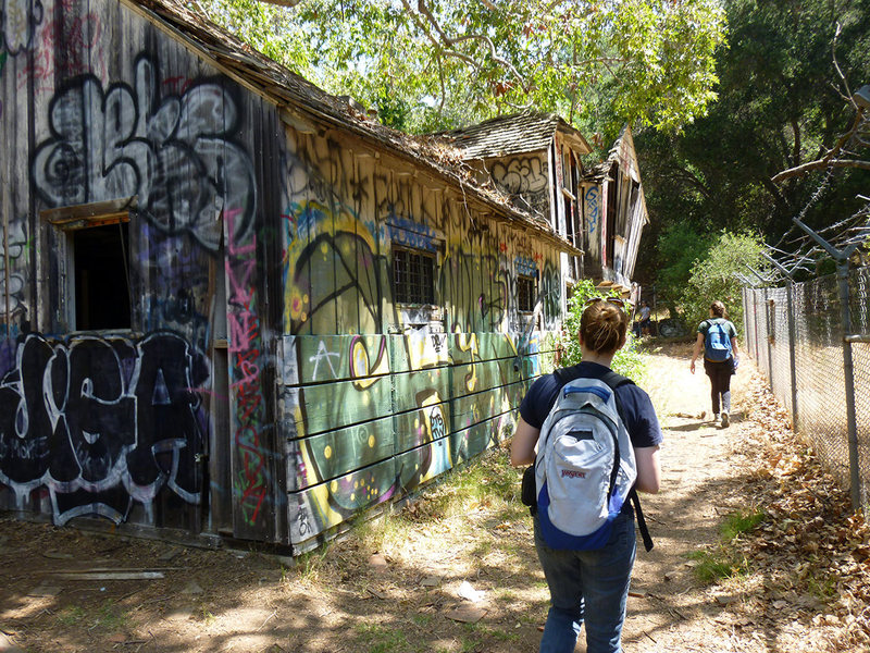
Rustic Canyon to Murphy Ranch Park hike
Location: 1562 Casale Rd., Pacific Palisades 90272
This unique moderate 3.85-mile loop hike is to an abandoned building that was transformed into an artists’ colony in the 60’s and 70’s. You’ll pass through a creepy entrance gate, to a collapsed machine shed and garage leading to an endless looking staircase. Finally, you’ll arrive at a large concrete building covered in spray paint housing a robust diesel generator and fuel tank. Sound interesting? This hike begins at the residential end of Sullivan Ridge Fire Road, but the ruins may also be reached by hiking up Rustic Canyon from Will Rogers State Historic Park. From the street parking at the intersection of Capri Drive and Casale Road, begin by walking up Sullivan Ridge Fire Road towards the creepy gate about 0.4 miles from the start at the entrance of Topanga State Park. A gap in the chain-link fence on the left side of the road leads to the top of the endless-looking staircase heading down the steep wall of the canyon. Turn left here and begin the dizzying descent to Murphy Ranch.
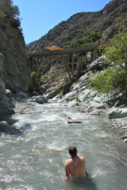
Bridge to Nowhere in the San Gabriel Mountains hike
Location: Camp Bonita Road, San Gabriel Mountains National Monument, Azusa, CA 91702
Trailhead coordinates: 34.23696, -117.765119
Pass required: An easy-to-acquire wilderness permit is required, as well as a national forest day use pass. The permit is free and the day-use pass can be purchased at the ranger station.
For outdoor-loving Angelinos, the Bridge to Nowhere is a local treasure! This abandoned bridge is located on a washed-away road in the San Gabriel Mountains spans across the East Fork of the San Gabriel River. The Bridge to Nowhere is a strenuous 10-mile round trip hike with 900 feet of elevation change. The path snakes along the San Gabriel River, passing Shoemaker Canyon before veering right. The trail hangs left and cuts north at Laurel Gulch, followed by crisscrossing the river. Allison Gulch gives way to Rattlesnake Canyon, and ultimately, The Bridge to Nowhere, which lives up to its name. The bridge was built in 1936 to connect the San Gabriel Valley with Wrightwood, which is along the Angeles Crest Highway. Now the bridge remains an arched curiosity, attracting river gold miners, terrific swimming holes, and perhaps L.A. County’s most popular place to bungee jump!
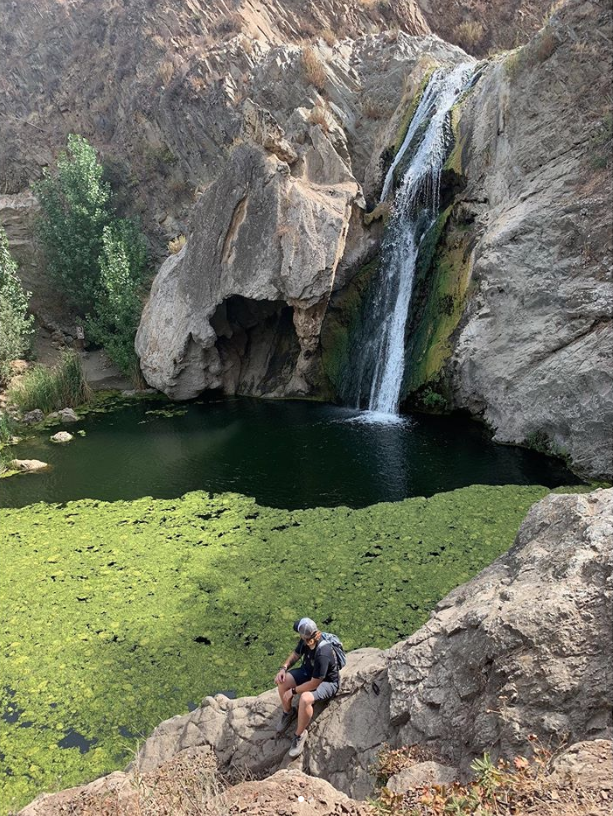
Hike to Paradise Falls in Wildwood Park
Location: 928 West Avenida De Los Arboles, Wildwood Regional Park, Thousand Oaks, CA 91360
Trailhead coordinates: 34.2200, -118.9028
Who can say no to a waterfall? The photogenic water feature is the 40-foot-tall Paradise Falls, tucked into Wildwood Park in Thousand Oaks. A roughly 2-mile hike to see the falls, the easiest route is to head straight west on Mesa Trail, the most obvious trail departing the parking area for Wildwood Park. Pass through a few junctions over the first 0.35 miles and turn left at a split onto North Tepee Trail, following an arrow for Paradise Falls. Paradise Falls plunges 40 feet into a large pool. Left of the waterfall is a rock grotto that looks alien to the surrounding landscape. Use stepping stones to cross through a line of cattails below the pool to get the best perspective of the Falls.